
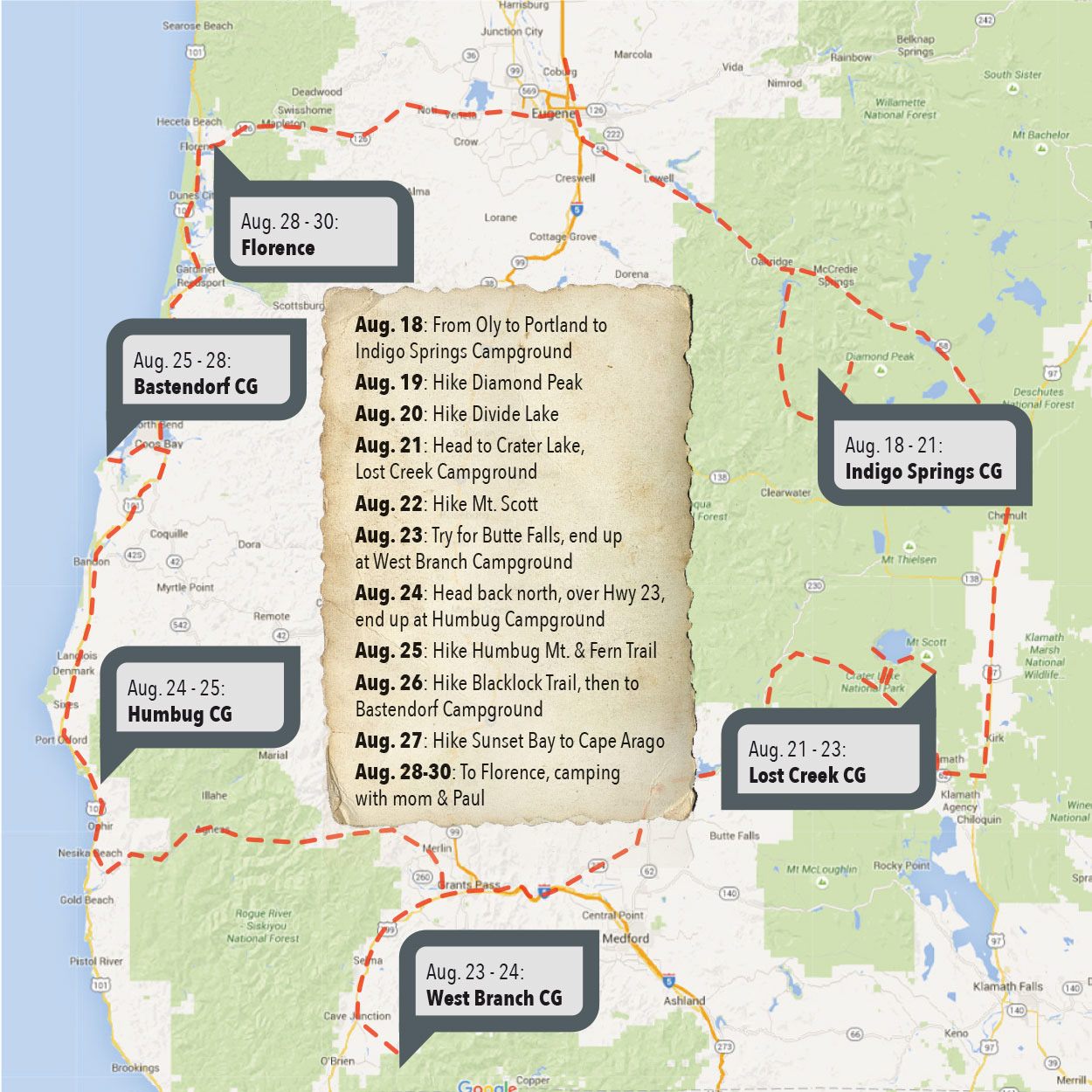
Why Southern Oregon?
Jamie and I met in 1994 at Southern Oregon State College in Ashland. We spend two years there, then moved to Olympia. In 2014, I drove to see a friend in Roseburg, and realized we hadn’t been back to that area since we left in 1996. So, almost twenty years later, we decided that our vacation this year would be a road trip down around the old stompin’ grounds. We didn’t end up making it back to Ashland, but it was fun getting to do some exploring around the area.
Thursday, August 19, 2015
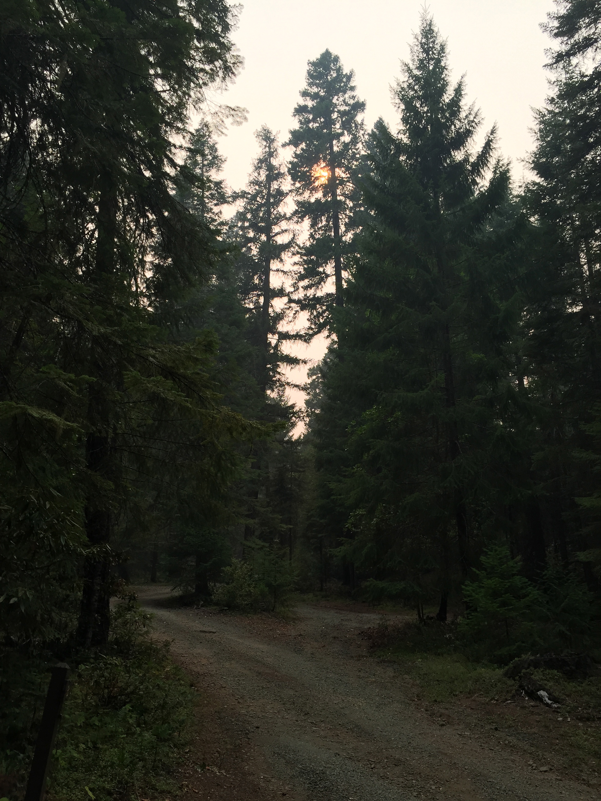
We got two nights to ourselves in Indigo Springs Campground. It was awesome! There wasn’t any rain, so no clouds in the sky. We fell asleep each night without the rain-fly on the tent. We got to see the stars in the sky while falling asleep in each others arms. But it’s now Thursday evening, and a car has pulled into a neighboring camp spot. They even have WA plates. Being alone in the world was fun while it lasted...
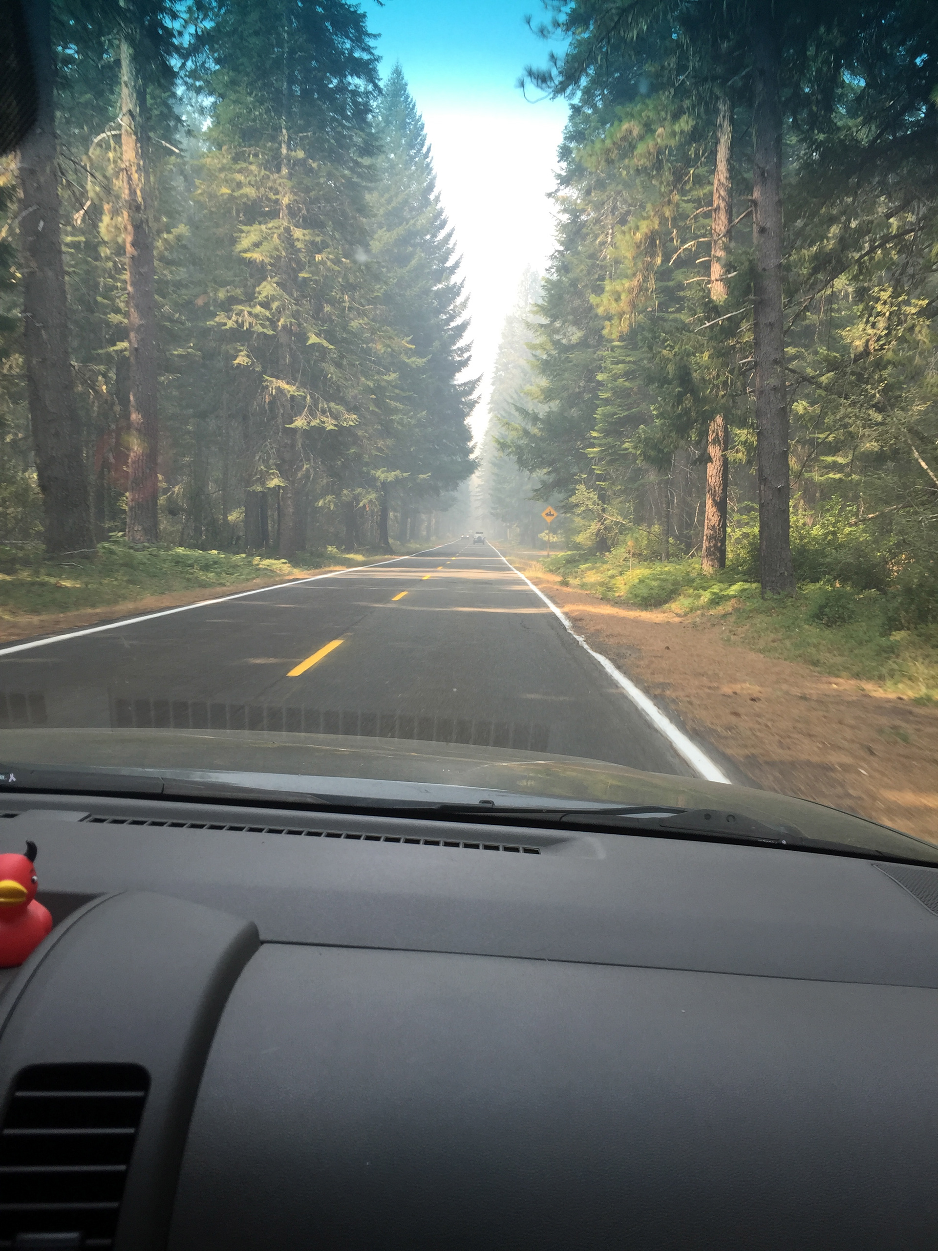
We left Olympia on Tuesday morning, and stopped in Portland to see Grandma. Then headed down I-5 to Eugene, taking Highway 58 to Oaksville. We stopped at the Ranger Station to grab a couple maps, stopped at Ray’s for water, ice, and sausages, then continued to Forest Service Road 23. We took the turn to FS 21 so we could make it to Indigo Springs for free camping. We stopped at a couple others along the way, but my cheapness won out, and we drove on. Success! Free and to ourselves!
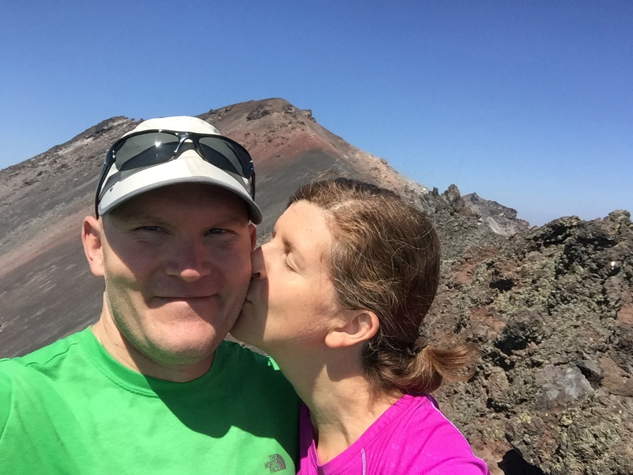
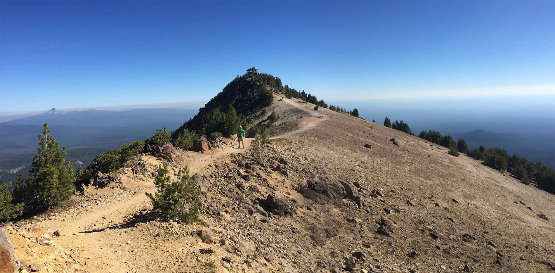
On Wednesday morning, we got up and hit the road for Diamond Peak. It’s 12 miles round trip, and it’s listed as difficult, but it was brutal! The last 1 1/2 miles to the first top was just a scree climb – rocks slipping out from under you at every step. We hit one peak, and could see another a little higher at what looked like maybe 1/2 mile. We stopped for a break – an apple and split a peanut butter bar – then went for the scramble to the top.
It looked a lot closer than it actually was, and we debated turning back. But we kept on thinking “We’re almost there.” As we hit the summit, I see another peak to climb! But I called “uncle”. I didn’t want to slip through anymore scree. So we turned and rock-skiied down to the tree-lined trail. That was a long hike. 12 miles, and we went from 10AM - 4:45PM. But we also stopped at a lake on the way back and took a dip. It felt great.
This morning we got up and headed to Divide Lake. This one was only 8 miles, and we got to jump in the lake halfway through. Lovely! Then we got back to the campground, grabbed some stuff, and headed back up FS21 to find a spot by the river for a swim. It was chilly, but we did some naked rinsing off, ha! Tomorrow we head back up to Oakville for supplies, then down to Crater Lake until Sunday.


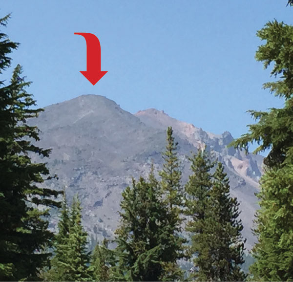
Here’s me at what turned out to be the false summit, viewing the real summit in the distance and crying Uncle. It looks alot closer than it actually was.

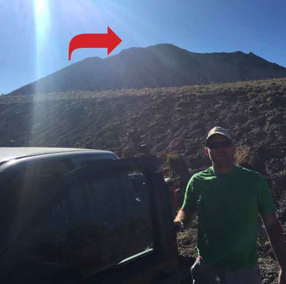
Here’s me at what turned out to be the false summit, viewing the real summit in the distance and crying Uncle. It looks alot closer than it actually was.
Saturday, August 22, 2015
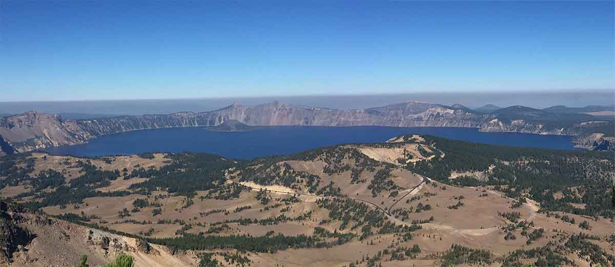
Today we hiked Mt. Scott – the highest peak in the Crater Lake Wilderness. It said it was strenuous but at only 5 miles round-trip, we thought we’d give it a shot. I don’t know why it was rated strenuous though, as we didn’t think it was that tough. The trail was nice, no skree fields to scamper through, and we made it to the top in 1 hour and 15 minutes. Beautiful view, and you can really see the smoke from the fire to the north.
We were back to the rig by 11AM, so we completed the whole hike in 2 hours. We still had some energy, so decided to hike Crater Peak too. It was also labeled as strenuous but was only 6.4 miles round trip, so off we went. It was also a nice hike and had some great views. We made it to the top, took some photos, ate a snack, then headed back down. Made it to the car about 2:30PM after also walking to Vidae Falls. Lovely.
We left Indigo Springs on Friday and went to Oakville for supplies and a burger. Jamie told me today that the men’s room at the Wagon Wheel Café (where we also stopped with Chad on the way down to the Sierras last year) had a sign that said:
If a man speaks in the forest
and no woman is around to hear him
is he still wrong?
Ha! I’m making that sign to hang in our downstairs bathroom. Hilarious.
and no woman is around to hear him
is he still wrong?
Ha! I’m making that sign to hang in our downstairs bathroom. Hilarious.
We headed back down Hwy 58 to hook up with 97, then to 138, then hit the north entrance of the park. But on the way past Chemult, we saw a warning light saying the North Entrance was closed due to a forest fire. So we had to stay on 97 to 422, then N on 62. A little longer drive, but better than a fire! Turns out, the fire was started by lightning. It’s been a dry year this year, and there are fires all over.
But we got into the park, hit Lost Creek Campground, and got one of the last two spots. Woohoo! We’re now sitting around a campfire (yes, they’re still allowed. Weird.), and I’ve been surveying our fellow campers. I don’t judge, but young men these days are wieners! They obviously spend a lot of time in front of a computer sporting the matching hipster beards. Just watching them try to build a fire, and (not) knowing how to be ready to put it out leads me to this assumption. I told Jamie this, and how it makes me appreciate how manly he is. He can do things – like build and put-out fires, re-sand and finish old wood floors (which he did last week), and just know how to fix things – that I don’t think our “tech-savy” world knows how to do anymore. I really respect him for that.
The red arrow marks the summit of Mt. Scott as seen from the parking lot.

Here I am at the trailhead marker.
There’s Jamie almost at the Mt. Scott lookout cabin. In the distance you can see Mt. Bailey (?), and the smoke from the fire in the north.

At the summit of Mt. Scott, with Crater Lake and the smoke in the distance.
Wednesday, August 26, 2015
I’m currently sitting in our campground while Jamie’s making dinner. We’ve spent the last half-hour setting up camp, and listening to our neighbor talk. There are other cars there, but she’s either just recording her own life story, or no one else is talking because she’s all we’re heard since we pulled in. But this just fits with how the rest of our day has gone. Let’s step back and pick-up where we left off at Crater Lake...
We got up Sunday morning, and Jamie made pancakes for breakfast. He pan-grills them in butter so they’re nice and crispy – mmmm! We finished breakfast, had some coffee, and watched our neighbors pack-up. Our plan was to pack-up, then hit Mazama Village because they had showers and a washer/dryer. We’d freshen up our clothes, and ourselves, then head to Butte Falls for the 7 Lakes Basin. After looking at the map, I knew the PCT(Pacific Crest Trail) went by Crater Lake, but I didn’t expect so many hikers to be stopping at the Village. As we pull into the registration area, there they swarmed. Filthy dreadlocks and all.
Jamie and I talked about it later, and what we’ve figured out is that both of us get antsy and short around large groups of people. We circled the lot for a loop looking for the showers. We couldn’t find them, so I made him stop at the main office to ask directions. In just the five minutes that it took, we had both hit our limit with people. I got back in the truck, saw the look on Jamie’s face, and said “Well, you wanna just head to Butte Falls and see what we find?” His immediate “Yes!” had us head out of the lot and down Hwy 62.
Jamie and I talked about it later, and what we’ve figured out is that both of us get antsy and short around large groups of people. We circled the lot for a loop looking for the showers. We couldn’t find them, so I made him stop at the main office to ask directions. In just the five minutes that it took, we had both hit our limit with people. I got back in the truck, saw the look on Jamie’s face, and said “Well, you wanna just head to Butte Falls and see what we find?” His immediate “Yes!” had us head out of the lot and down Hwy 62.
As I mentioned before, the North Entrance of Crater Lake was closed due to fire. I didn’t know there were other fires happening, but as we headed south on 62, and noticed the smoke in the air getting thicker, we realized there must be more areas ablaze. We made it to the Butte Falls turn-off, but the air was so thick we decided to continue to Grants Pass and make our way down 199 to Tannen Lake in the Red Bluffs Wilderness. We saw a laundromat in Shady Cove, so we stopped to do the wash. The owner was there, so I asked him if there were any public showers we could use. He told us to head to Rough Elk campground and ask for Betty. While the clothes were in the wash, we went to the Lunch Box deli, and had a fabulous lunch. Then went back to put the clothes in the dryer, and went looking for Betty and a shower.
Crater Lake
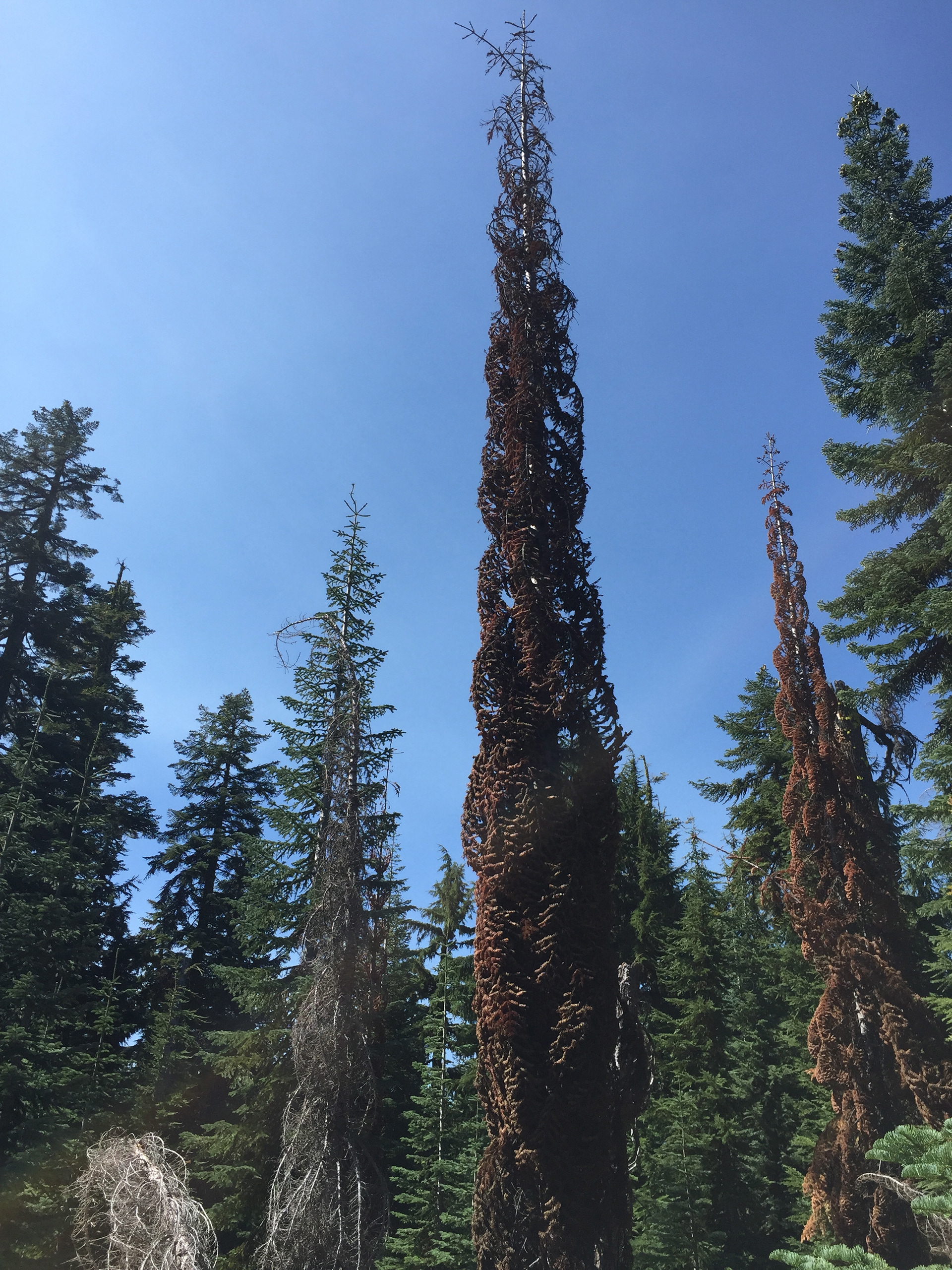
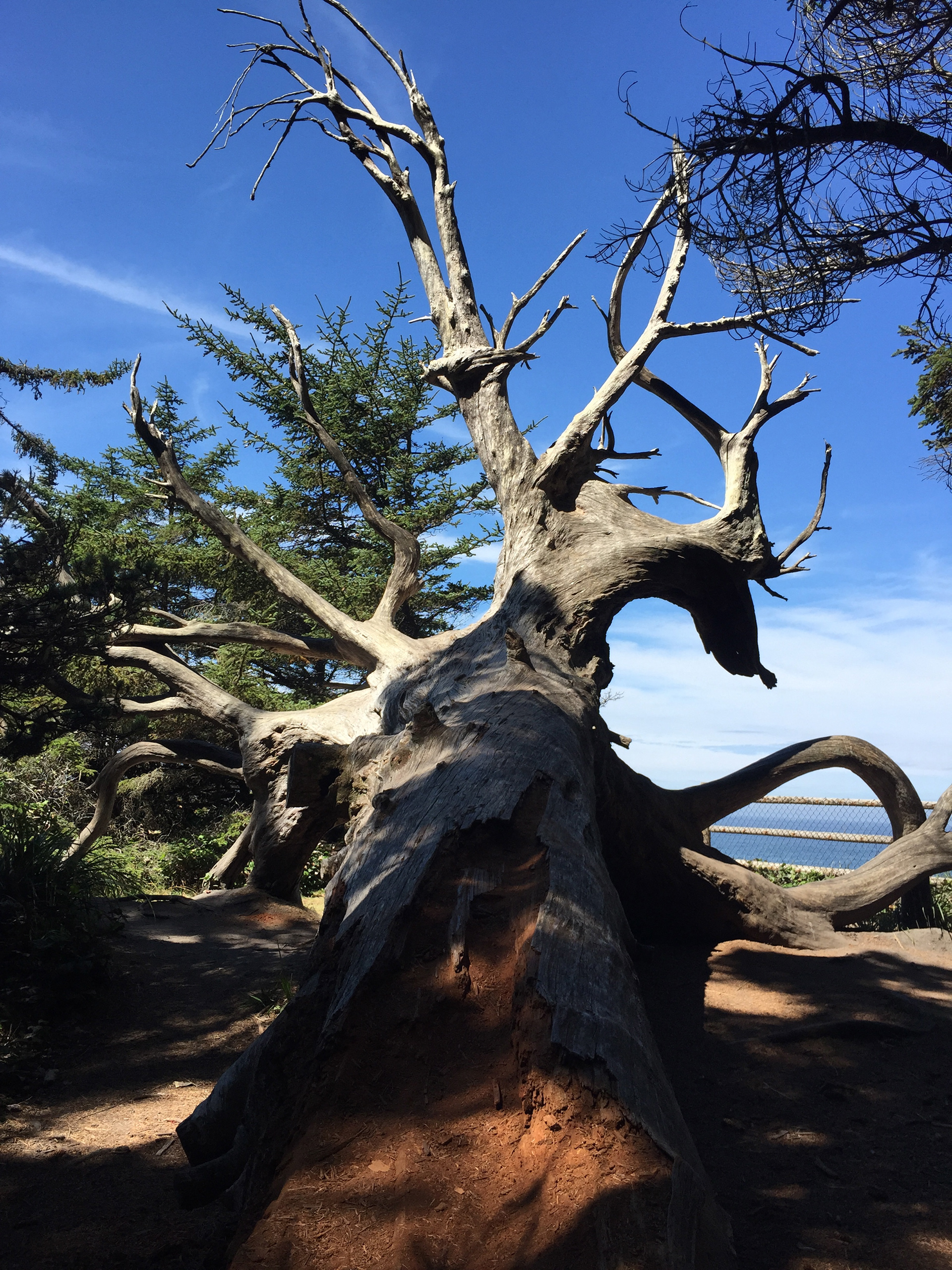
These trees are on the Crater Peak hike. They look burned, but notice how the branches are turned into the trunk. Neith of us had seen trees do this before, so wondered what caused it. Maybe bug investation?
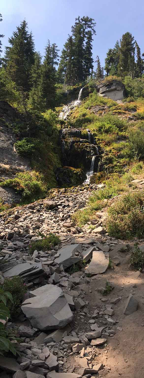
Videa Falls
Smoke from the forest fires filling the air between the trees on Hwy 62.

Getting ready for lunch at the Lunch Box in Shady Cove.
Wednesday, August 26, continued
We found the park, and even found Betty, and showers were on! They felt so good! We then made it back for the dry, clean clothes, and continued through Grants Pass.
After an hour or two of driving, we were on Happy Camp road looking for the Tannen Lakes trail sign. We didn’t see one, so we continued down the road looking for a camp. We finally came upon West Branch campground, and turned in to check it out. I don’t know if it was the smoke in the air, the old Pepsi can and branches still sitting on the tables, or the fact that NO ONE else was there, but it felt like the campground of the damned! After driving around a curve, we saw and RV, and a guy walking his dog outside of it. We stopped to talk to him, and he let us use his map to see if we could figure out where we lost track. We couldn’t but he was really nice, and it was getting late, so we decided to camp and reevaluate our plan in the morning.
We took a little walk, then set up camp and settled in to read. We started getting attacked by mosquitoes, and no amount of bug spray was working. We couldn’t have a fire, so we just sat in the truck until bedtime. Luckily, we made it through the night without getting sucked into our own version of the Blair Witch Project, and woke up the next morning. Because of the smoke, and because we couldn’t find our trail, we decided to head back up 199 to Hwy 23 and shoot for Agness and the Copper Canyon and Illinois River trail.
Hwy 23 is an interesting road, and neither of us had been on it before. It’s really just one lane, is very curvy, and is closed in the winter because of that. It was a pretty drive, but one sign we passed said the 40 miles takes about 3-4 hours, so give yourself time. You won’t go over 30mph. We made it to Agness, but realized too late we made the wrong turn if we wanted to got to the Illinois trail (when Hwy 23 comes to a T at a big bridge, go right toward Agness for Illinois trail), so we continued on the Gold Beach. We stopped there for supplies and gas, and made our way to Humbug Campground.


Lonely picnic tables at the campground of the damned.
Evening at the campground of the damned. Notice the sun clouded in forest fire smoke. Very spooky.

A cool bridge we went over at the end of Hwy23. This is where we should have gone right for the trailheads out of Agnes.
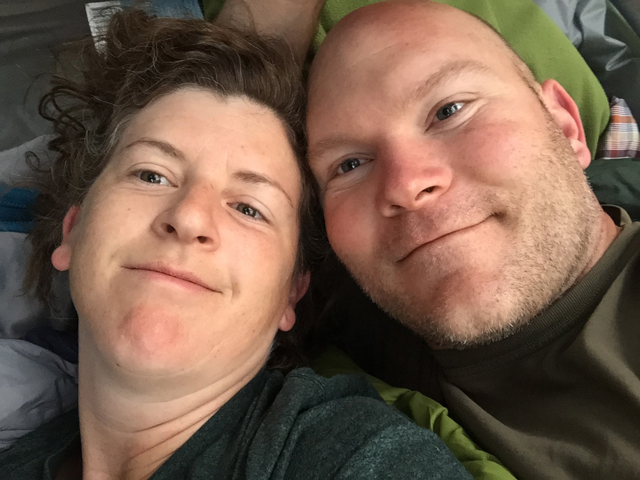
Good morning!
Wednesday, August 26, continued
Camping on the Oregon coast is very popular, and really no longer operates under the “first come, first served” approach. This is very frustrating for people who don’t want to plan ahead. I think it’s even more frustrating for us because deep down we feel like since we’re Oregon natives, we should have either more rights for, or easier access to, camp spots. Sadly, Oregon Parks campgrounds don’t see it that way.
We stopped at Humbug Campground because in our search for hikes around the coast, Humbug Mountain came up. It’s not long, only 6 miles round-trip, but it at least had some elevation and some distance. We drove past the Humbug Mountain trail sign, and it said they also had camping, so we pulled in. We lucked out, and they even had a tent camp spot available. Experience taught us that Oregon Coast camping is tricky. It my look like a site is available, but it may have already been booked, they just haven’t posted the reserved sign. We found a site that would work, checked the reservation board, it was open, so we went to book it. We wanted two nights, so I called the reservation number provided to also book for the next night. I went through the whole reservation process, and they told me the total was $25. This was more than the posted night fee, so I asked why. I was told there was an $8 registration fee!! This had not been communicated before I made the call, or went through the process, so I was a little upset. Luckily, I hadn’t given my credit card info yet, so I canceled the reservation and hung-up. While I was telling Jamie about what happened, and we were complaining about their bullshit system, and a nice park-helper – with a waxed, curled mustache – came up and asked it we needed help. We told him the story, and he said not to worry. We could just ask the part host if the site was open, and they’d help us. We ran into them later, and they helped. Super nice people, and we had the spot for two nights. Woohoo! So we set up camp, grabbed a drink and some water, and headed down to the beach. We hung-out watching the waves for awhile, then headed back to camp. When we arrived, we had some new neighbors, and we started up a conversation. They were form Ontario, Canada, had flown into Seattle, rented a car, and were driving down to San Francisco for two weeks. Then they’d fly home from San Fran. They were a very nice couple, left their business cards on our table the next morning, so we’ll probably email them to say hi.
On Tuesday morning, we got ready and set out on the Humbug Mt. trail. Luckily, we could get to it right from the campsite, so we didn’t have to drive anywhere. As we got to the trail head, we noticed a couple ahead of us that were on it, too. But the were in work-out clothes, and started jogging. We’ve been told we hike pretty fast, but they stayed ahead of us, so good for them! We met at the summit, and they were here from Boulder, CO. They were maybe mid-late 50’s, obviously in fantastic shape, and were here to see her mother. We talked about hiking, and lack-of-snow and rain this year, then Bend came up, then we said our good-byes and headed back down the hill.
Jamie and I still wanted to walk some more, and it was only 10AM, so we headed out on the Fern trail, also accessible from the campground. The camp host had told us about it when we were figuring out camp site, and said it was a decommissioned section of Hwy 101. You could follow it all the way to Port Orford. So we climbed a small hill to get on it, and it was kinda weird. There’s old pavement that’s being taken back by nature, so we laughed about how it felt like we were in the Walking Dead. The world has ended, so maintenance no longer happens, ha!
We walked for awhile, found a viewpoint, so we stopped and ate a snack. We decided to head back to camp, grab some supplies, and go lay on the beach and read. It was so lovely! The sun was out, there was a nice breeze, and we had the beach to ourselves. We broke up our reading by running down to put our feet in the water, then flip sides. It was perfect.
After a couple hours, we headed back to camp, and went to take showers. Then went into Port Orford, and hit Bonnie & Leslie’s Bar and Grill for beer and fisn-n-chips. The beer was from Arch Rock, which was brewed in Gold Beach. We tried the Porter and the IPA, and they were delicious. We ordered the 2 piece fish with 3 fried prawns and homemade fries. So good! The waitress was super nice, and a few locals came in, too. We all ended up talking for a bit about the town and the beer. It made me feel very at home.
After a couple hours, we headed back to camp, and went to take showers. Then went into Port Orford, and hit Bonnie & Leslie’s Bar and Grill for beer and fisn-n-chips. The beer was from Arch Rock, which was brewed in Gold Beach. We tried the Porter and the IPA, and they were delicious. We ordered the 2 piece fish with 3 fried prawns and homemade fries. So good! The waitress was super nice, and a few locals came in, too. We all ended up talking for a bit about the town and the beer. It made me feel very at home.


One of the viewpoints on HWY 23.


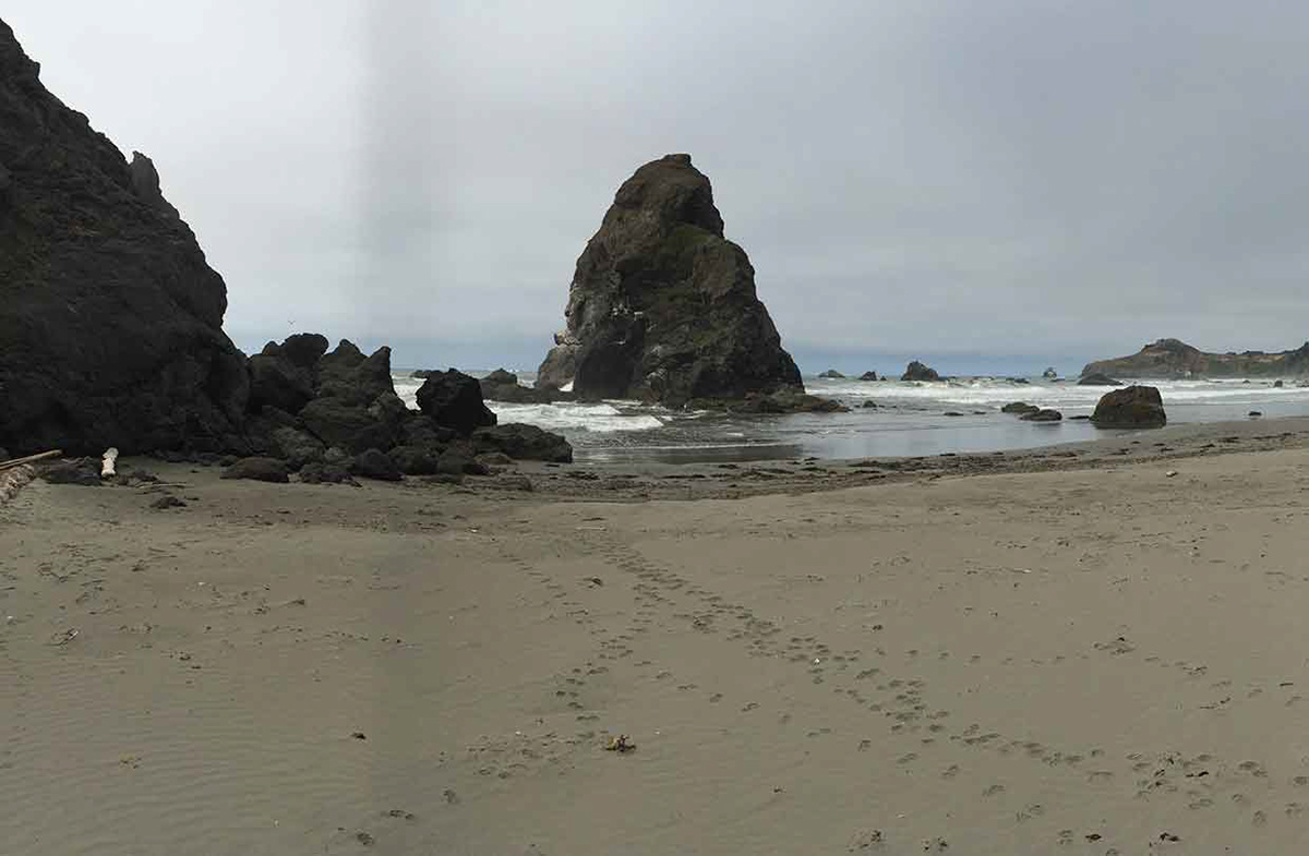
Beaches around Humbug Mountain.


Stayin' alive!

You can’t see it, but there’s a whale in there!

Wednesday, August 26, continued
After dinner, we went back to camp and walked to the beach to watch the sunset. Again, pretty much had the beach to ourselves. On the way back to camp, we passed a family that was having a hard time. The wife was in a Rascal Scooter that her husband had equipped with riding lawn mower tires. The idea was she’d be able to make it to the beach with them, but I guess the motor wasn’t powerful enough to roll her through the sand. The husband had a rope tied to the chair, and he was trying to pull while the two kids pushed. But they weren’t getting very far. So we offered to help pull, and we got her to the sidewalk! They were so happy, they said we saved them like an hour. They made a comment about living in Butte Falls, and I mentioned we tried to go there, but got smoked out due to the fires. She said if we ever made if back there, they’re in the log house on the corner of 6th – stop by!
We got up the next morning and headed North on 101 to Coos Bay. We were going to walk the Blacklock Point trail, then see if we could find Sunset Bay Campground. Blacklock Point trail turned out be about 8 miles. It was a lovely walk, and had beautiful scenery. We made it back to the car, then stopped in Coos Bay for supplies. Then west on Hwy 540 to the campground – beginning the hour of frustration. We waited for the camp host to be available, then asked for some camp spots that would be available for the next two nights. He highlighted them on the map, so we went to find them. What a shit-hole. Not only did a lot of the camps just have their garbage spewed everywhere, but there was no space or division (like bushes or trees) between the spots. Of course, Jamie and I are already getting irritable because we’re around lots of people, but also seeing their crap just helps bump it up a frustration level. So we decided to drive back to Coos Bay, then head up and west on 241 to see if we can’t find something in the North 10 mile area. Now, before we had even hit Coos Bay – totally frustrated – I see a sign saying left to Bastendorf Campground! I yell at Jamie to turn and check it out. They still had empty tent spots, which had nice bush divisions between each spot – so we went to the Park Host to take our spot. It was a bit of a maze to actually find someone who could help us, but we finally did. He was super nice, and our preferred spot was available both nights. So we pulled in, set up camp, and even got to end the day with a campfire. Whew.
Here we circle back to the start of this entry, and give an update on crazy neighbor. She’s moved on from constant, loud, speaking to drunken karaoke.
Thursday, August 27, 2015
Today is our last day of camping by ourselves. We still get to camp this weekend, but we’re meeting Pam & Paul in Florence tomorrow to spend the weekend with them. It’ll be fun! We’ll probably check out Old Towne Florence tomorrow, maybe Jamie will get some taffy, then go kayaking on Saturday. Then we’ll head home Sunday and get to see the cats.
We got up this morning and had pancakes topped with peanut butter and syrup. Mmm. Then went down the hill, parked at the Sunset Bay Park, and hit the Oregon Coast trail again. We hiked the Sunset Bay to Camp Arago, which we have conflicting info, but might be about 8-9 miles. It was a beautiful walk. At Simpson Cove we got to see all the seals, and heard all their barking. We ventured to various beaches, and looked in the tide pools. On the way back, we even got to see some whales swimming and spouting in the distance. A lovely day, and a nice end to our time. Tomorrow we head to Florence to meet up with Pam, Paul and Mary Beth. It’ll be fun.

All of these rocks are covered in seals! We could hear them barking from a mile away.

Beaches around Cape Arago State Park.

Beaches around Cape Arago State Park.
Cool trees along the trail.

Cool trees along the trail.

Cool trees along the trail.

